KR3 THREATENS PUBLIC SAFETY
In 2013, the forebay of sister project KR1 failed catastrophically, causing a flood that eroded the mountainside and a landslide that closed Highway 178 for 10 days
ISSUE: Transporting millions of pounds of water every minute in an elevated manmade conduit above a major road is inherently dangerous. The catastrophic failure of sister project KR1 in 2013 proves that the regulatory framework governing project safety is inadequate.
OUR TAKE: KR3 poses a significant threat to public safety.
DETAILS:
In 2013, there was a catastrophic failure of KR3’s sister project KR1, both along its water conveyance and at its forebay, causing erosion of the mountainside resulting in a landslide that completely closed Highway 178 for 10 days.
FERC subsequently increased the hazard rating on KR1 from “low” to “significant.”
KR3 has a similar configuration to KR1: an elevated concrete water conveyance and forebay 821 feet above a major road.
KR3 transports up to 278,256 gallons or 2,309,524 pounds of water every minute — 50% more than KR1.
A catastrophic failure of the KR3 conveyance, forebay, or penstocks would send all of this water downhill, eroding the mountainside and deluging Mountain Highway 99 (aka Sierra Way).
OUR PROPOSAL: An independent engineering firm should evaluate the risks KR3 proposes to public safety and identify measures that can decrease those risks.
EDISON’S RESPONSE: The current regulatory framework is adequate.
HOW TO HELP: Tell FERC (click the link for instructions),
Who you are;
How much you care about the North Fork Kern;
That you are concerned about threat to public safety posed by the KR3 hydroproject;
That you want an independent engineering firm to evaluate project safety; and
You support Kern River Boaters’ Public Safety Study Proposal.
GO DEEPER: Read (1) KRB’s Public Safety Study Proposal and (2) Lois Henry’s article on the KR1 Landslide. Watch this 25-second video of the KR3 siphon:
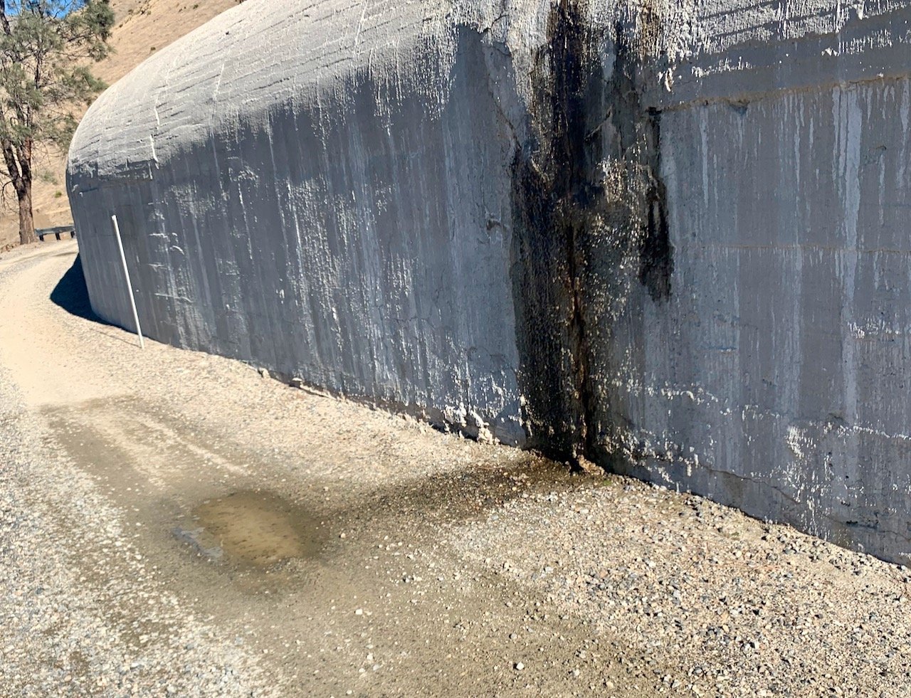
Recent images of the KR3 conveyance above M99:
The highly pressurized siphon:
Lois Henry, “Mother Nature got help shutting down Hwy 178,” Bakersfield Californian, March 29, 2014, reprinted below:
Mother Nature may have gotten a bad rap on those landslides that closed Highway 178 during the height of tourist season last August.
A tremendous storm whipped through eastern Kern County and dropped heavy rains in the Kern River Canyon the night of August 19.
Rock, mud and debris skittered down the canyon walls and closed the highway in at least two places near the Southern California Edison power plant a few miles east of the mouth of the canyon.
It took Caltrans 10 days to get the road fully open again, at a cost of more than $500,000.
In January, Caltrans sent Edison a bill for the full cost of the clean up. Whaaaaat?
Yes, as it turns out, Caltrans believes the Edison power plant facilities were the cause of the slides.
Not so, Edison spokesman Paul Klein said.
“We would not characterize this as Edison being at fault,” he said. “This was a weather event.”
Not surprisingly, the Caltrans bill has gone unpaid.
Klein said he couldn’t comment on the status of the bill because he hadn’t had time to research exactly where it was in Edison’s system.
The power plant was shut down after the incident and only recently came back online in late February. Edison is still working to repair damage from the storm to its facilities and it’s only yet in the consultation stage with the U.S. Forest Service to come up with a plan to stabilize the badly eroded hillside.
While there has been no independent investigation of the landslides, a letter from the Federal Energy Regulatory Commission (FERC) sent to Edison earlier this month clearly pins the cause of at least one of the two slides on faulty Edison facilities, specifically a retaining wall.
The commission has ordered Edison to file a lengthy report on how it will prevent a similar failure in the future. The letter also changed the hazard rating of the project from “low” to “significant,” which will mean increased inspections by FERC.
A low rating means a project would have essentially no impact were it to fail. Significant means it might have impacts to structures or some environmental impact. A rating of “high” indicates a probable loss of life should the project fail.
I’m not sure why the project wasn’t pegged at “high” since it was just pure luck that no one was driving on 178 when the landslides happened. But no one asked me.
At this point, many of you are probably wondering how a powerhouse in the river could be the cause of a landslide from hundreds of feet above.
It’s pretty interesting actually.
The powerhouse, known as Kern River 1 (KR1), isn’t fed by the natural flow of the river.
The water that makes the power comes from behind Democrat Dam, 14 miles upriver from KR1.
Water from Democrat travels by tunnel and flume high along the south canyon wall to a “forebay” (essentially a regulating station) above KR1. From there, the water drops by pipeline down to the powerhouse where it spins the turbines and gets dumped back into the river.
The whole system is gravity fed, no pumping. And, by the by, it was all constructed back in 1906 (they didn’t even have an app for that back then!). Fascinating.
Anyhow, on the night of August 19 the heavy rains created flash floods that charged down the sides of the canyon.
There’s an access opening that’s used to get into the KR1 tunnel for maintenance a few hundred yards east of the forebay.
A landslide crashed through a retaining wall above the access point and busted it open before continuing down to cover Highway 178.
Water, rocks, mud and plant material rushed into the access opening and was carried to the forebay.
There is an emergency spill pipeline at the forebay that should have moved that flood water and debris safely down to the river. But the opening was covered by a grate that became plugged.
The forebay was inundated.
Water overtopped the structure and eroded a huge chunk of the hillside, which came crashing down onto 178.
The forebay does have monitoring sensors and Edison workers were alerted, but no one could get to the structure as the highway was blocked even further up from the powerhouse, according to Danielle Chupa, Edison’s Eastern Hydro Division chief.
“This was purely a Mother Nature situation,” she said.
Well, not entirely.
In a letter to FERC dated Nov. 1, 2013, Edison states the retaining wall above the access opening (which it described as a “kneewall,” which is typically very short, under three feet) will be replaced by a wedge-shaped concrete wall to deflect water and debris around the access opening.
Oh, and having a grate over the mouth of the emergency spill pipeline probably wasn’t a good idea either and will be corrected, Edison also notes in its Nov. 1 letter.
In its March 12, 2014, letter back to Edison, FERC sums up that: “The cause of the overflow incident is the failure of the retaining wall …” above the access opening, which set everything else in motion.
Mother Nature may have started the ball rolling, but Edison’s facilities clearly helped her out.
Now, about that $500k …
Opinions expressed in this column are those of Lois Henry, not The Bakersfield Californian. Her column appears Wednesdays and Sundays. Comment at http://www.bakersfield.com, call her at 395-7373 or e-mail
We also have teed up information about five other areas in which KR3 harms our river, the natural environment, and the human environment:
Aesthetics ºº Angling ºº Environment ºº Health ºº Whitewater
Please have a look at these resource topics and send your views on them issues to FERC and other managing agencies. Do not simply assume the agencies will resolve these issues in the public’s favor; they have failed in the past and Edison is well funded and politically connected. Speak up now for yourselves and the future. And please consider following our Free The Kern Facebook campaign page. Together, we can Free The Kern.


